


Text Coming Soon!
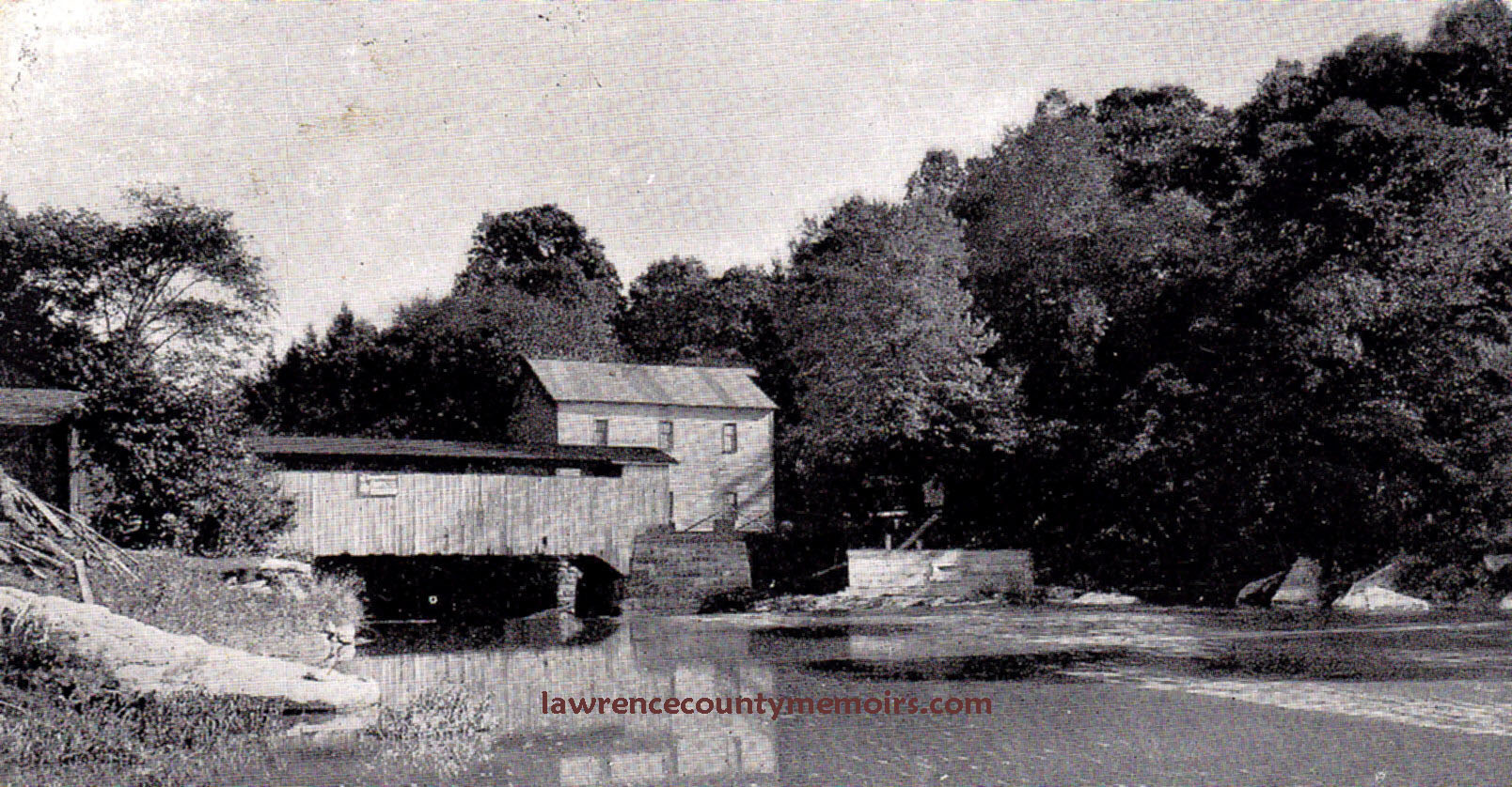 Kennedy Mill and covered bridge along the Slippery Rock Creek. From a postcard postmarked August 11, 1909. Mabelle of Harlansburg writes to Miss Sarah Wright in R.F.D. #6 New Castle, “Hello Sarah, How are you this fine day. I am all by my lonesome so I thought I would send you a P.C. I suppose you did not have any more accidents before you got home Sun. night. You tell J—- to be sure and come up to church Sun. morning. Maybe I will go down with him Sun. night if you don’t have the mumps before that time. Mabelle.” |
 A postcard from about 1915 showing the area around Kennedy Mill. The Kennedy-Steiner-Huff family owned the nearby Kennedy Mill Farm property (on the right bank) for many years. | 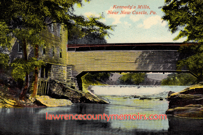 The covered bridge across the Slippery Rock Creek was replaced by a metal truss bridge that opened in the summer of 1928. The mill closed down in the 1920’s and was torn down long ago in 1933. |
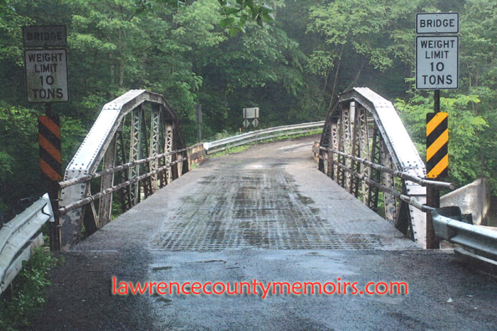 This metal truss Kennedy Mill Bridge, also known as the Frew Mill Road Bridge, was opened in the summer of 1928. It cost $7,000 and was designed by prominent county engineer Thomas A. Gilkey, who helped design many of the bridges in Lawrence County including the Mahoning Avenue Viaduct. It was apparently built on the existing abutments of the old covered bridge. (2007) |
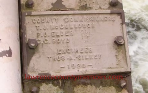 The plaque on the steel bridge indicated it was designed by Thomas Gilkey and built in 1928. (2006) |
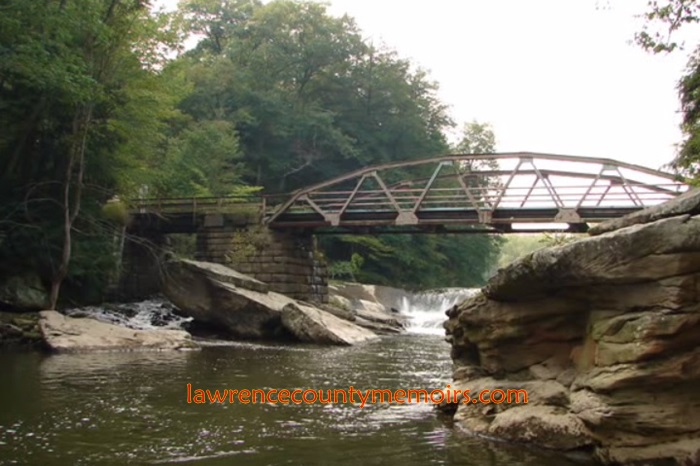 The rural location of Kennedy Mill Bridge is very scenic. (2005) |
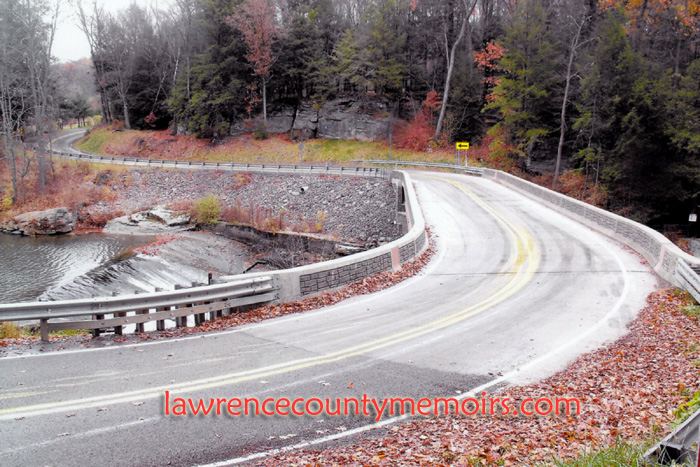 The single-lane metal truss bridge was replaced beginning in April 2007 with a modern concrete deck two-lane bridge, that was raised and built over the existing foundations of the old bridges. (Nov 2009) |
 A view of the new bridge looking southward. You can notice the bridge passing over the original abutments on the left hand side of the photo. A few miles downstream is the historic mill and covered bridge at McConnell’s Mill State Park. (Nov 2009) | 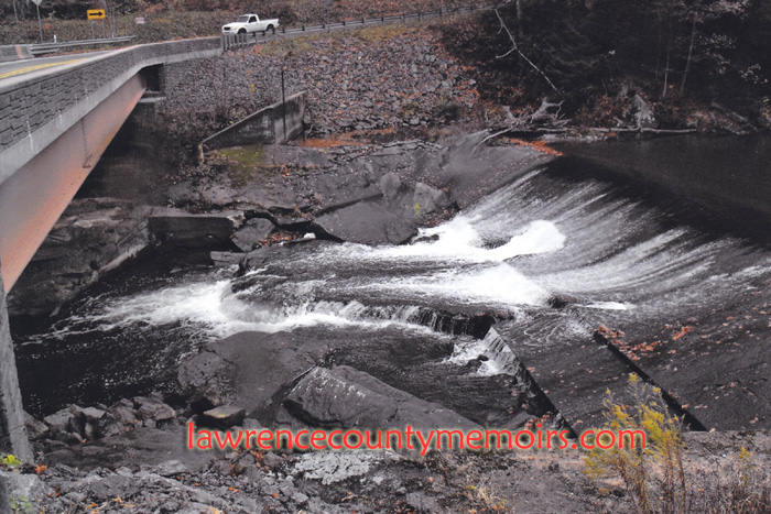 Water flows over the old dam and some of the original dam spillway work is still very evident along the shore. Just above the dam (to the right) is a very popular swimming location during the summer months. Kayakers can also be frequently spotted here going over the falls. (Nov 2009) |
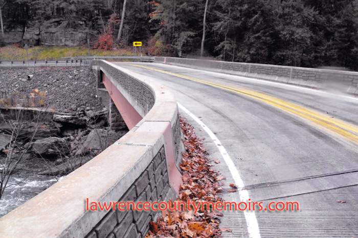 A view of the deck of the new bridge, located in a very secluded location on Frew Mill Road. (Nov 2009) |  The scenic view from the bridge while looking southward. (Nov 2009) |
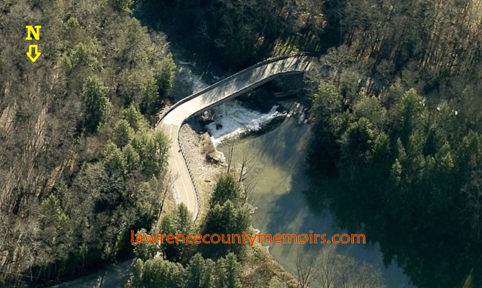 An aerial of Kennedy Mill Bridge on Slippery Rock Creek. (c2009) |
Comments
Mike Dean #
Just on the east side of the bridge on the hill is a very large square cut out in the rocks that was once was roofed and used to store ice cut from the creek, delivered and sold in the summer for the old iceboxes.
Alan Dudash #
The last photo is looking south, not north.
Jeff Bales (EDITOR) #
(EDITOR’S NOTE) Mike, great info about the ice house. Alan, yes, you are correct. Photo #9 is actually looking southward as the creek narrows. Thanks. Jeff
Al Snyder #
As a child, I remember walking southward down a trail on the oposite side of the bridge from the mill. That was back in the 60s. I believe that section is now private property.
Jean Gilmore Nagle #
I spent my summers growing up in Rock Falls Park in the 50’s and 60’s. Any sites that show older pictures and history you can send me to would be appreciated.
Virginia Allain #
I’m so excited to see these vintage images, while working on my Kennedy family genealogy. I’ll put a link on Ancestry so other descendants can come see it here too.
David McCormick #
Thanks for the pics and history. I remember this area from my younger days.
Comment