


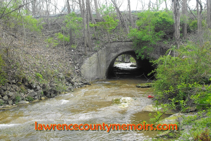
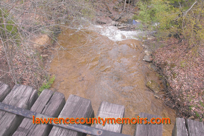
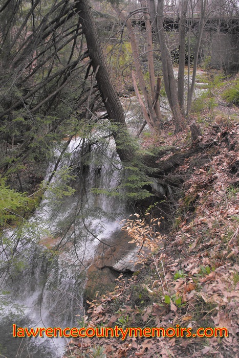
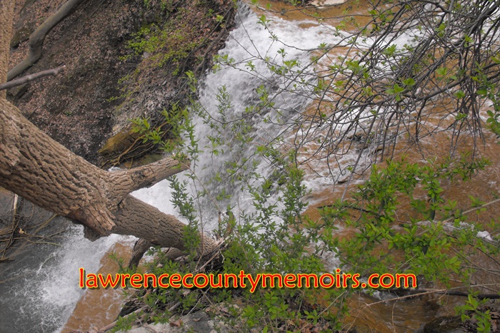
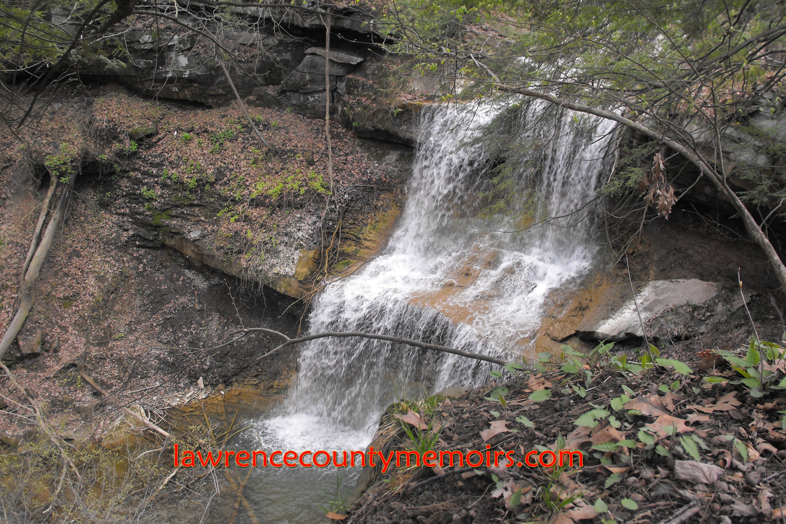
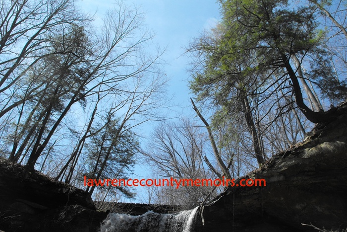
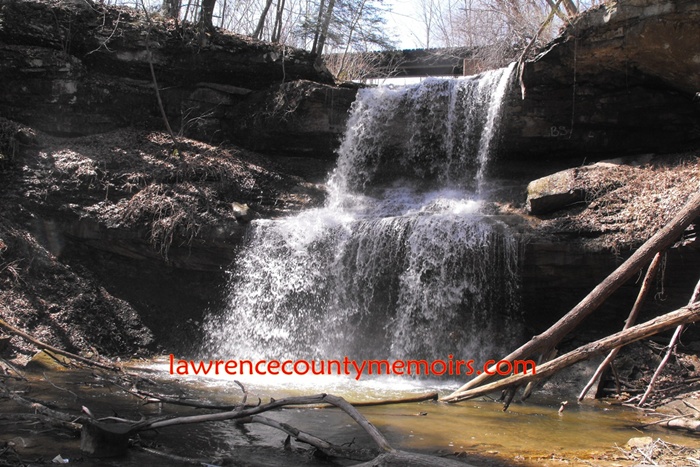
Quakertown Falls is a fifty-foot waterfall on Falling Spring Creek located just west/northwest of the town of Hillsville in Mahoning Township, Lawrence County, Pennsylvania. The waterfall, also known as Quaker Falls or Poland Falls, is located in a deep gorge just north of Route 224 and about a half mile east of the Ohio border. Falling Spring Creek is supplied by runoff from the various mining operations around Hillsville and flows northward into the Mahoning River.
The falls got its name from a small group of Quakers, members of the religious order known more formally as the Society of Friends, who settled the area in about 1800. The Quakers initially set up mills along the Mahoning River, but soon relocated just south to the area around the falls. At this location they set up mills and other businesses along the creek and established Quakertown, which later became a thriving little village of 200 people. The settlement slowly transformed into a farming community and by the early 1900’s, as its residents migrated to find work in the coal and steel industries, all traces of its existence were but a memory.
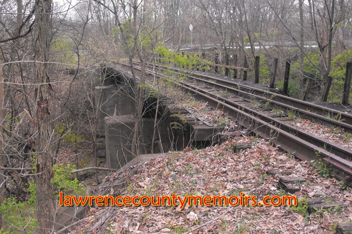
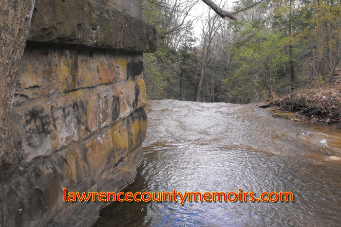
Spanning the creek just above Quakertown Falls is an old railroad bridge. That small bridge, originally built in 1894 and reworked over the years, was utilized by the Pennsylvania & Lake Erie Railroad (P&LE) for many years until abandoned in the late 1970’s. It was part of a branch road off the P&LE mainline, starting near Lowellville, Ohio, and reaching down into Hillsville and Bessemer.
The area overlooking the falls is accessible via a dirt road turnoff from Route 224, but is not necessarily easy to find. The turnoff and the falls are not designated or distinguished by any sign or marker. The falls itself, which can be reached by a steep trail, is unfortunately not part of any park or nature area and has probably never been seen by the vast majority of the motorists who pass by on the highway above.
 (Apr 2012) | 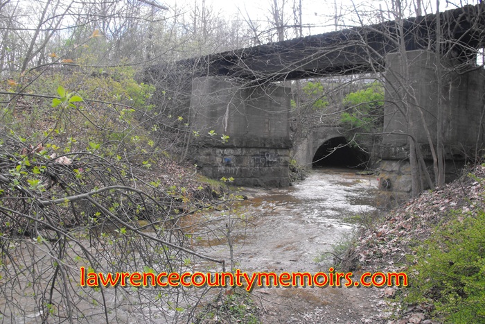 (Apr 2012) |
 (Apr 2012) | 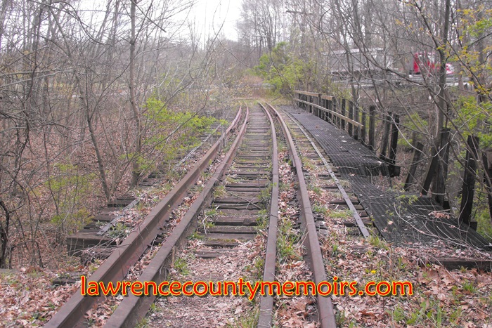 (Apr 2012) |
 (Apr 2012) | 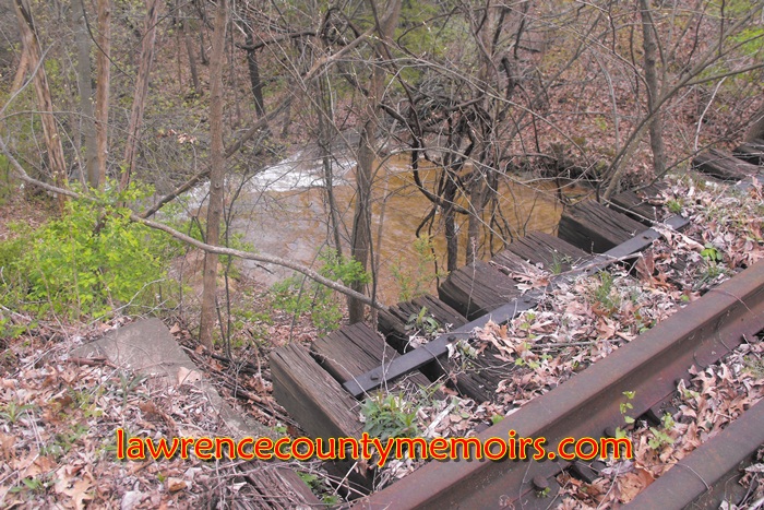 (Apr 2012) |
 (Apr 2012) |  (Apr 2012) |
 (Apr 2012) | 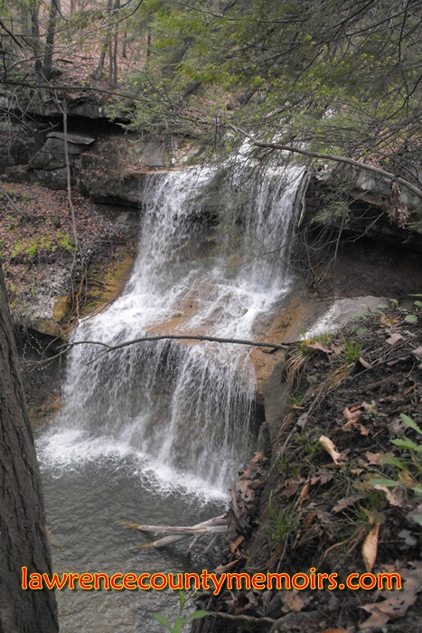 (Apr 2012) | 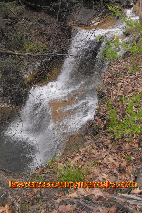 (Apr 2012) |
 (Apr 2012) | 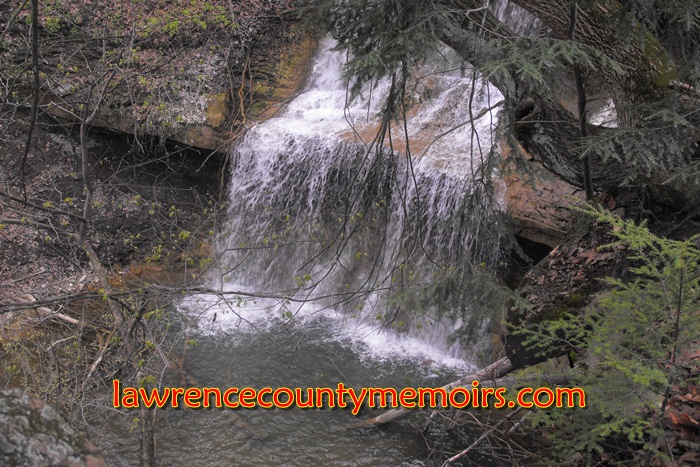 (Apr 2012) |
 (Apr 2012) Full Size |
 (Apr 2012) |  (Apr 2012) |
 (Apr 2014) | 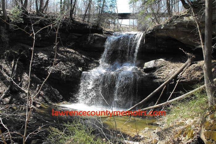 (Apr 2014) |
 (Apr 2014) |  (Apr 2014) |
 (Apr 2014) Full Size |
Comments
Kevin Kelley #
ive been hunting back there before and I have noticed a few falling down buildings and there is also a cemetery back there. Do u have any information on the buildings or old cemetery plots back there?
D.C. #
I have also found the old buildings and cemetery. One building looks like it may have been some type of train depot at one time. I have also found old wells and cabin foundations. Additionally, I have located bottles dated from the 1800s scattered around these sites.
I did some research and found out this area was the site of the original Quakertown, founded by a Mr. Septemus Cadwalladder between 1800 and 1804. It just so happens that one of the stones in the abandoned cemetery reads “Septemus Cadwalad,” “Died 1814.”
C. Dean #
My husband and I have done extensive hiking in that area. If you cross the old railroad bridge, you turn right, then cross what appears to be a ditch you see the falls. There is an old sandstone quarry to the northeast of the falls. If you bypass the ditch and don’t look at the falls but follow the trail to the northeast, past the quarry, the ditch starts up again. That ditch was the old mill run,you will find where it opened into the mill pond, follow it to the edge of the cliff and you can see where the mill wheel stood.
CB Nash #
I hiked this area a few, well, more than a few years ago. The brick building that is largely intact was a powder house from the mining operations. There was a stone house that stood on the flat lands North of the railroad track. The dirt ramp that led to the barn was still there. These were remnants of the Cadwaller farm. Members of the Cadwaller family lived in nearby Lowellville, OH.I was told that in later years, the house was used to shelter immigrants when they first arrived in the US.
The road that led from the area near the tracks up the hill to the cemetary was still distinguishable. I believe all of this property is owned by First Energy Corp.
CB Nash
Robert #
I was back at the falls today and I found an old brick building off to the side.I was looking for the grave yard but I know I was far off.If you found the cemetery please e-mail me at rlf8010@hotmail.com and help me find out where it is from the falls.
BillyJoe Utsinger #
I know where it is. I grew up there. Ruff directions. Stay on the road side of the falls. Walk away from the tressel crossing. Look for a 4X4 trail through a mud hole leaving the road. Follow that trail past some junk piles go under the power lines. Continue into the woods again. before the trail goes down a sortof steep hill look left into the woods. See a 2 to 4 foot high rock brick wall 20 yards off the 4X4 trail. That’s it. lots of stones some you can read. late 1700 to mid 1800. that’s a 15 to 20 years ago recollection. Good luck. easyer to spot in the snow.
michele #
I was at the falls today and hiked northeast looking for the cemetary or buildings foundations. Couldnt find them. Should i have been across the street? If i am at the top of the falls roadside, which direction should i go? Thanks for any help.
DB Brown #
The grave site was due east of the falls. Go slightly east (50 to 100 yards maybe) of where you park for the falls on 422. There should be a 4×4 trail, if it is still there, that will take you in the general area. If you get to to the creek you’ve missed it. There were old foundations & other ruins in the area. There was a wall aroung the cemetary made from huge stone blocks & oddly, there was no entry way (if memory serves me). I do remember a tombstone that simply says “wife of Jacob”. Very erie place, me & Billy Joe Utsinger used to stomp around there quite a bit like 20 years ago.
B #
224 not 422
Gary #
How far do I go on the 4 × 4 trail to get to the cemetary? Is it near the creek? We followed it to the 1st and 2nd cutoffs to the left. Found walls of 1 building thats all. please help.
Kitzi #
Was out their today and they blocked off the dirt road and were in process of posting it private property
D.C. #
Yep, after someone recently got hurt jumping off the falls into the water, First Energy posted numerous No Trespassing signs. I would heed the warning, as I’m sure Mahoning Twp. Police will be keeping a watchful eye on the property.
There’s always someone who ruins it for everyone else.
Denise Guthery #
Recently, it was announced that the falls area will become a state park! It is truly beautiful and we will be fortunate to enjoy it as a park!
Kerry #
Is there anyway to still get to the cemetery?
Vickie Hutton #
This should be updated as there has since been many improvements to the area. There is now a designated sign along the highway and an official park. Most recently improvements were made earlier this year including a small pavilion and stairs with a viewing platform at the bottom so you can clearly see the falls. There are also two viewing platforms that have been added above on the side across the old railroad bridge that now serves as a pedestrian bridge across the creek at the park.
Comment