


Text Coming Soon!
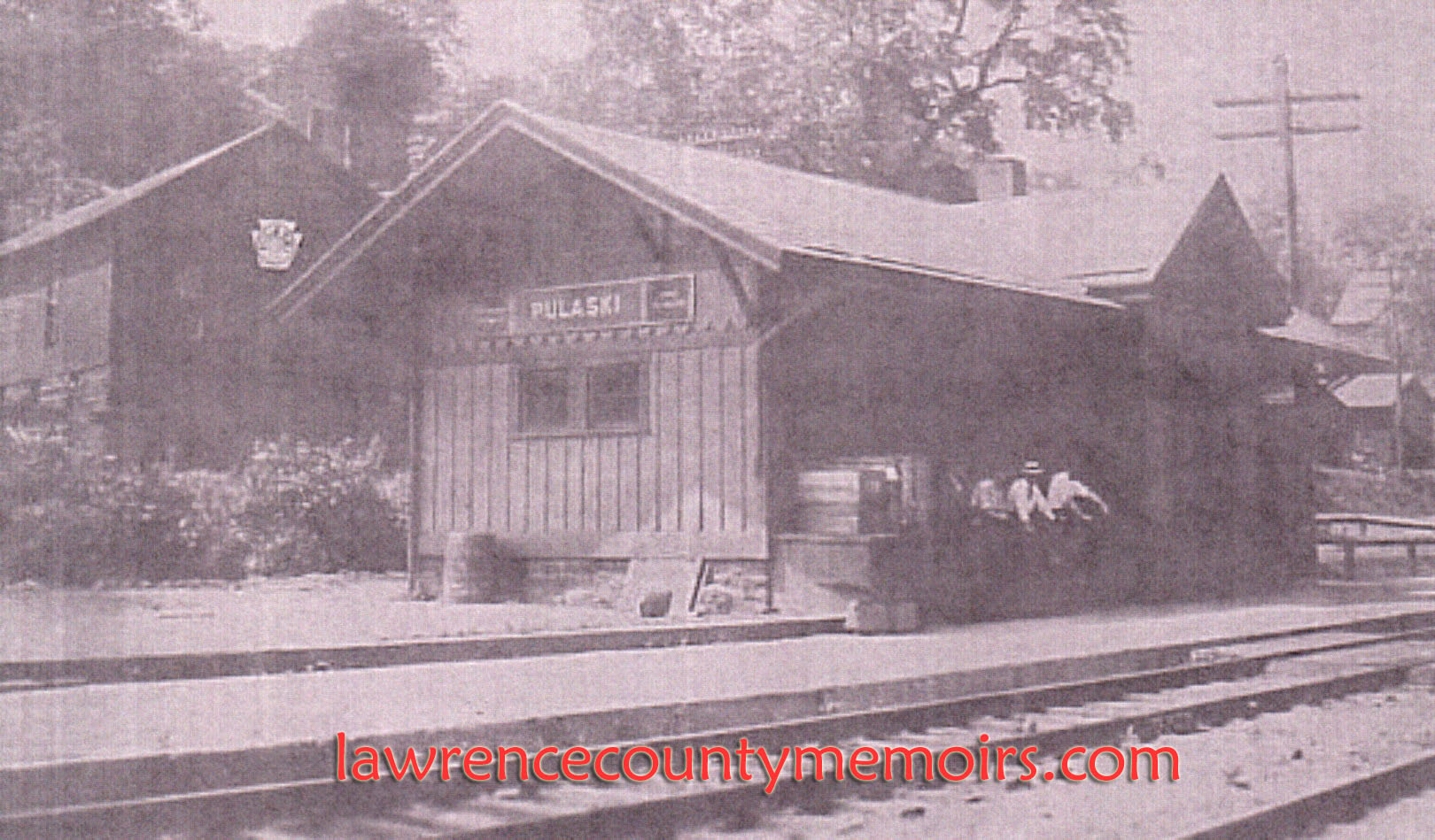
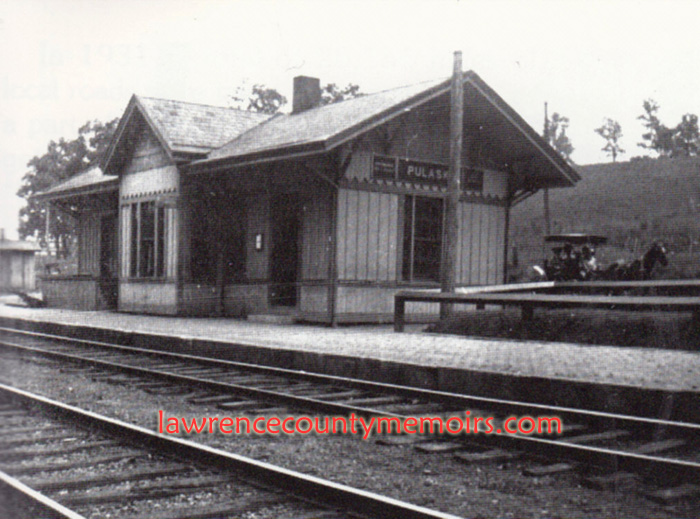 In August 1864 the Erie & Pittsburgh Railroad (E&P) opened a thirty-one-mile branch – along the west bank of the Shenango River – from Jamestown via Sharon down to New Castle. The E&P was leased by and came under the control of the powerful Pennsylvania Railroad (PRR) beginning in 1870. Before too long several train stations were opened along the route, including one near the village of Pulaski. (c1905) Full Size |
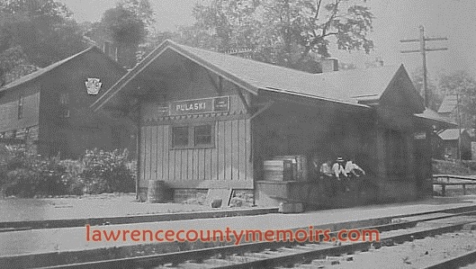 The E&P/PRR station at Pulaski was located on the west bank of the Shenango River – in an rural area south of the Pulaski Bridge. The public road (now Route 208/551) runs right behind the train station. In the late summer of 1931 the stop was made a “non-agency station,” meaning it would no longer be manned by a P&LE agent. In early 1952 the PRR ceased all passenger service at this location, but continued with limited freight operations for a few years. This station was razed by 1957. (c1918) Full Size |
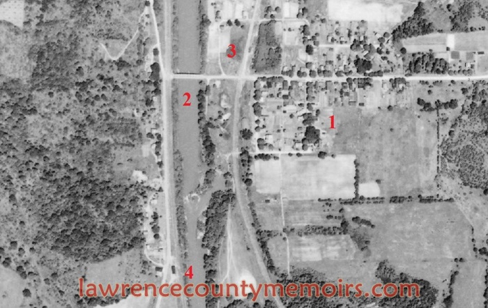 This map shows the locations of the two train stations once located in Pulaski. To help you get your bearings the area north/west of #1 is the village of Pulaski, while the Pulaski Bridge is situated near #2. The train station of the Erie Railroad (ERIE) is to the right of #3 and east of the tracks that ran through the edge of the village. The E&P/PRR train station depicted on this page is south of the village. It’s the dark building immediately left of #4 – where the road splits off towards the southwest. (June 1939) |
Comments
DEE #
Please tell me , where was this train station, I love it
Jeff Bales Jr. #
(EDITOR’S NOTE) Dee, thanks for the post! The E&P/PRR train station in Pulaski was located on the west bank of the Shenango River, in an isolated spot about 600 yards south of the Pulaski Bridge. If you look on a map – it was located right where Route 208/551 starts to bear off to the southwest. It was located between the road and the double tracks that ran close to the river. The Erie Railroad, which ran on the opposite side (east bank) of the Shenango River, had their own train station and it was located in the village of Pulaski. Jeff
Steven #
My friend found Nancy’s island using Google Earth I believe. You have to know what to look for to find it. The river no longer flows around it, at least not all the time but perhaps during heavy rains. I don’t know whether it was intentionally cut off from being an island or not but I do plan on checking it out at some point.
Comment